Screen any location instantly with 21 years of wind data, then run high-resolution Large-Eddy Simulations (LES) of your own site. One self-service platform for wind development, from first screening to detailed resource and wake analysis.
Better wind data for more confident project decisions
Complex sites, without the guesswork
Forests, ridges and coastlines are where standard models struggle. Whiffle resolves their effect on the flow, so you rely less on corrections and judgment calls.
Proven accuracy
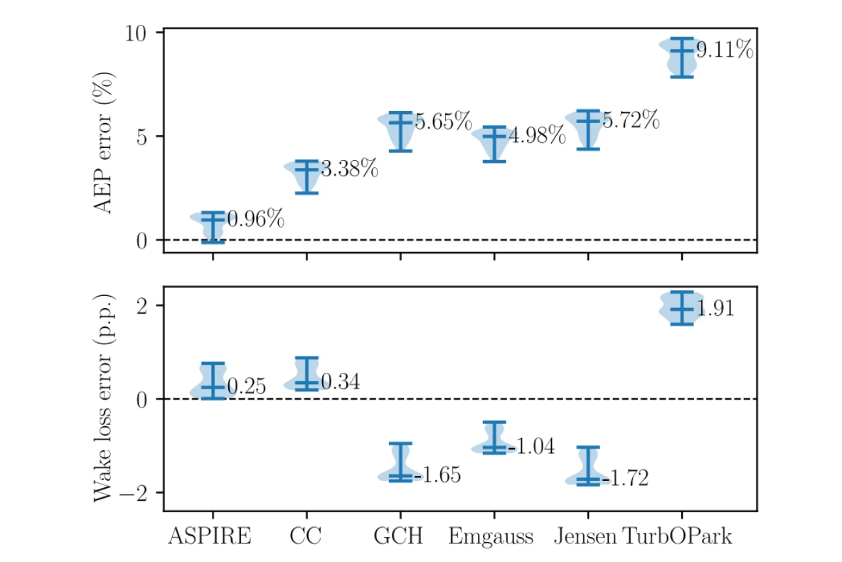
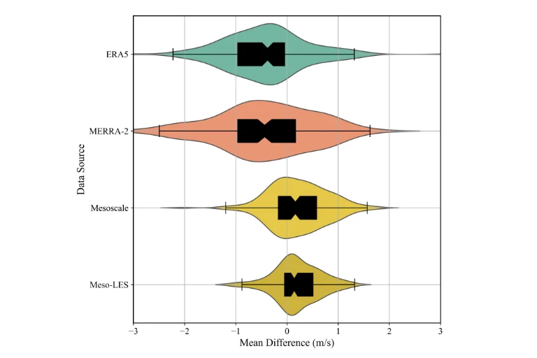
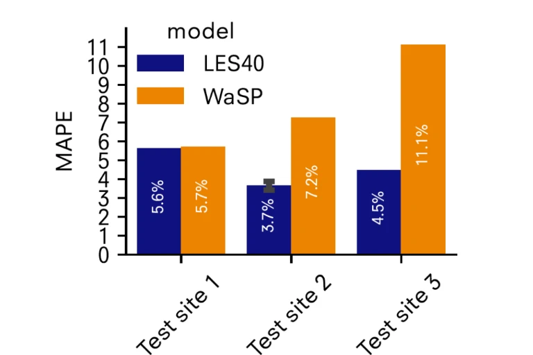
Validated against real-world measurements, with demonstrated improvements in wind-speed and yield estimates across benchmark studies.
Fast enough for every project stage
Look up long-term wind data instantly. Most simulations are delivered the same day, and you see the exact price before you run, not after.
Data & outputs
Start broad, then zoom in
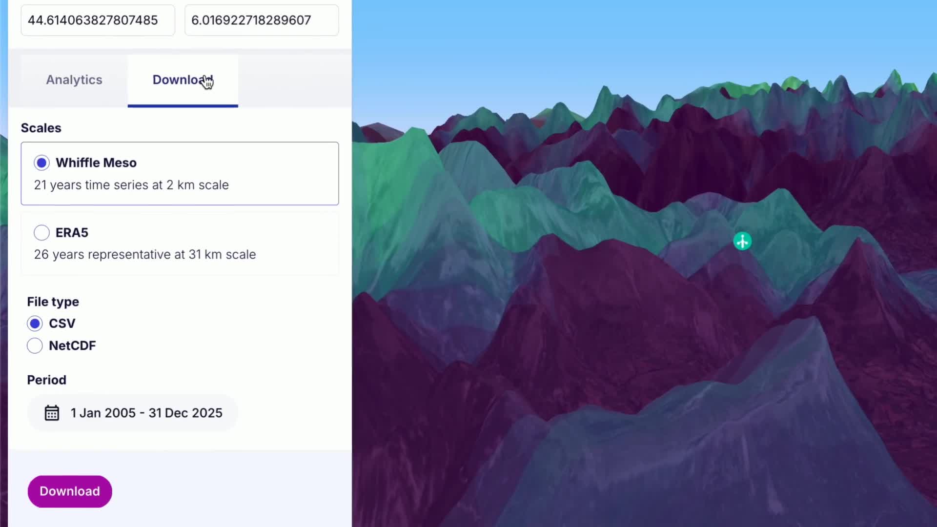
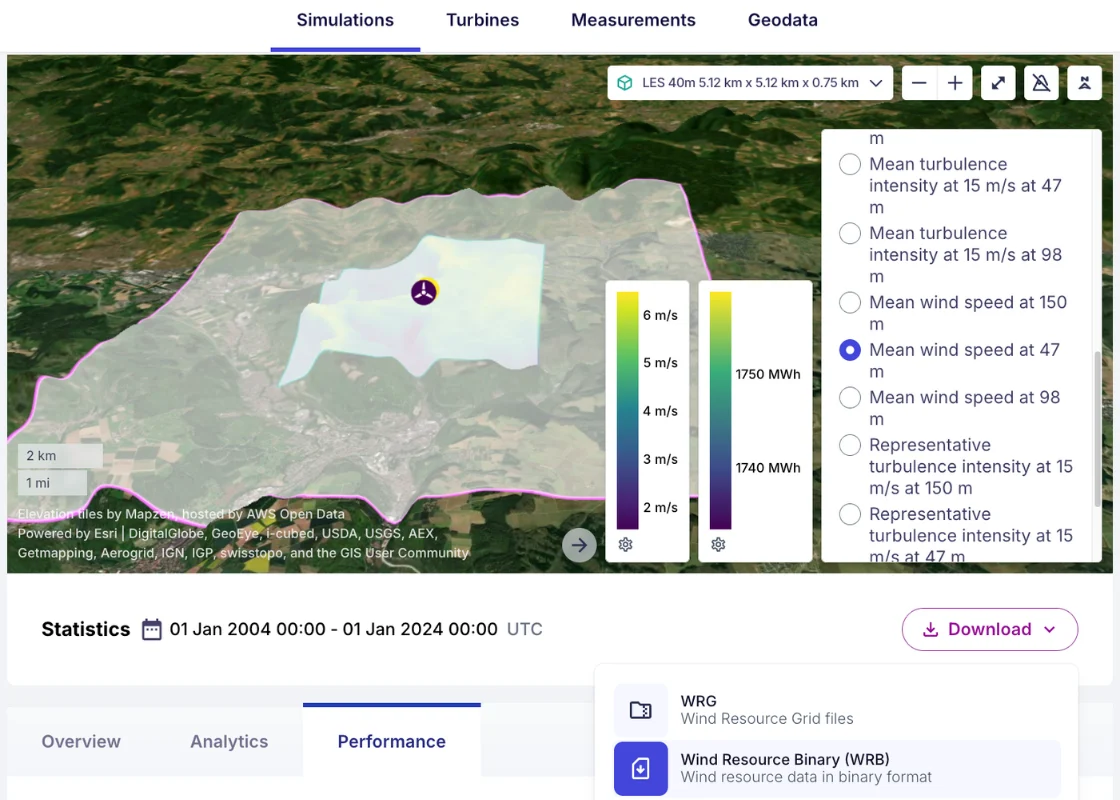
Look up 21 years of wind data for any location in seconds, then simulate your own site in full LES detail. Explore and download results through the Whiffle platform, or integrate them into your workflows via API.
21 years of hourly data at 2 km resolution
15 variables at 10 heights, from 2 to 500 m
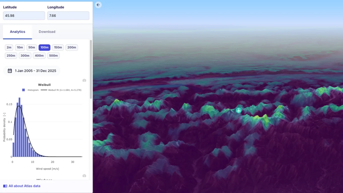
Free statistics preview before you download
100 m resolution across your whole site
Long-term representative
WRG and NetCDF, ready for WindPRO, WAsP and Openwind
10-minute resolution
From a single day to a full year
NetCDF and CSV
Long-term wind data
Look up hourly mesoscale data at any location in our coverage to compare candidate sites and characterize the wind climate. ERA5 reanalysis is included for reference.
Wind statistics
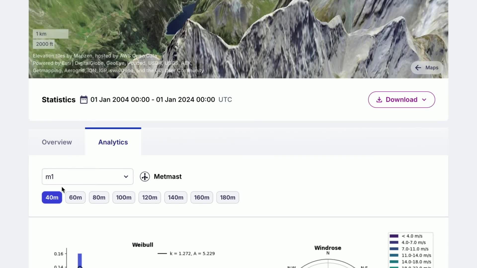
Explore LES-derived wind statistics, including Weibull distributions, wind roses, shear and turbulence, for wind resource, energy yield and site suitability assessments.
Wind time series
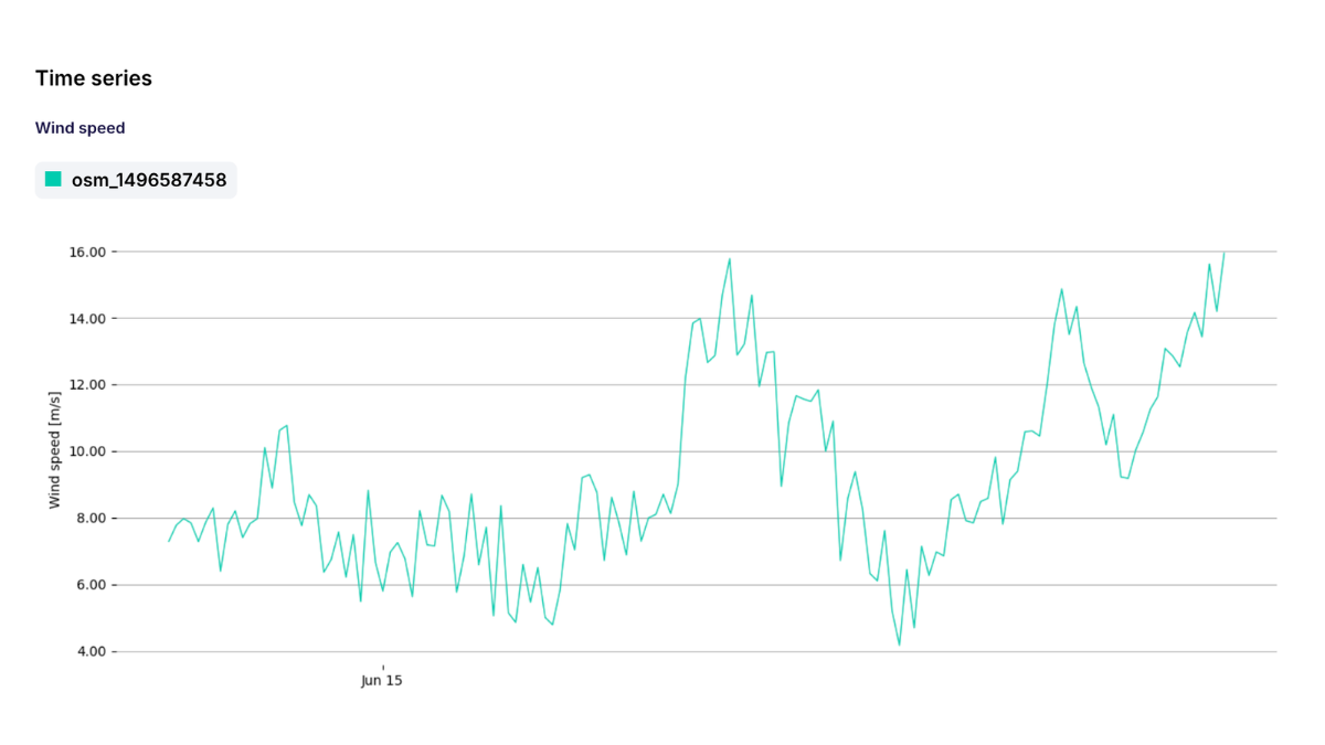
10-minute wind data that captures how wind, turbulence and atmospheric stability interact beyond averages. Ideal for analyzing wakes, production profiles and specific wind events.
Applications
Answer the key questions in wind project development
Site screening and wind resource
Compare candidate locations and characterize the long-term wind climate, including shear, turbulence and stability.
Measurement campaign planning
Decide where to place met masts and LiDARs, then generate simulated data at those locations to compare with your measurements.
Turbine and site suitability
Turbulence intensity, shear, veer, inflow angle and air density at every turbine location, as input for turbine selection and loads.
Blockage and wake effects
Quantify internal wakes, neighboring wind farm effects and blockage as input for your energy yield assessment.
Platform capabilities
Configure and analyze your site, your way
Set up your site in minutes with your own turbines, measurements and terrain. Run at 100 m, or down to 40 m for the most demanding sites, then take the results straight into the tools you already use.
Add your own turbines
Add any turbine model with its own power and thrust curves, and get power, thrust and wake effects at every position.
Calibrate to your measurements
Upload met mast or LiDAR data and get results calibrated to your site, plus simulated data at every measurement location to compare against.
Bring your own site data
Import terrain and land use as GeoTIFF when standard datasets miss the detail, and your layouts as KML, GeoJSON, shapefile or CSV.
Model neighboring wind farms
Add surrounding wind farms and see how their wakes affect production on your site.
See the wind, not just the numbers
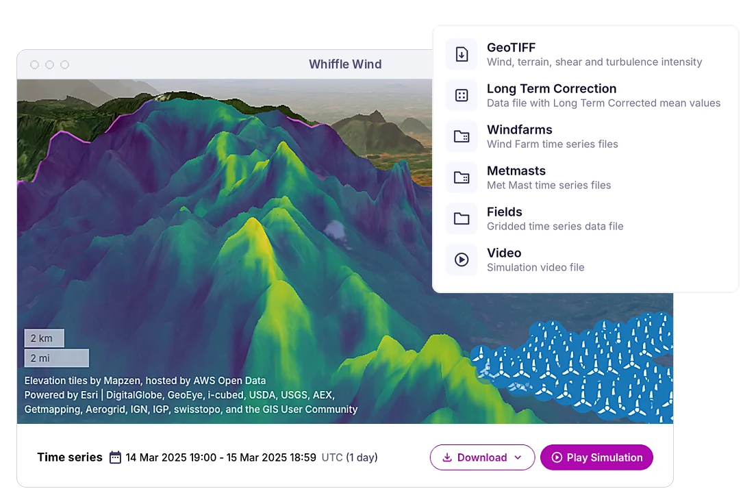
Every simulation comes with a video of the flow over your site, plus maps of wind speed, turbulence and terrain to download as GeoTIFF.
Integrate with your engineering tools
Export wind data as WRG, NetCDF, CSV for tools like WindPRO, WAsP, Openwind, or access results programmatically through the Python API.
Screen sites with long-term data or run a simulation of your own site, all in one platform.
Select your location
Click any point for instant long-term Atlas data, or draw your project area to set up a Whiffle Wind simulation.
Configure and run
Add turbines, measurements and site data, choose statistics or time series, and see the exact price before you submit. Most simulations are ready the same day.
Explore, download or integrate
View results and simulation videos in the platform, download them for your engineering tools, or pull them into your own workflow through the API.
Validation & Accuracy
Validated against measurements and operational data
Whiffle's modeling has been benchmarked against wind measurements and operational wind-farm data across a range of site conditions.
We have made Whiffle a standard part of our assessments going forward after some impressive performance at a few complex sites. Despite our significant time zone differences, the Whiffle team has always been appropriately responsive when we need help.
Jared Kassebaum
Director, Energy Team, EDF Power Solutions
Atlas is a major step forward in long-term wind modeling – driving deeper understanding of long term trends for projects dominated by mesoscale effects and terrain induced complex flows.
Jeffrey Snyder
Senior Wind Resource Analyst, GE Vernova
Through our joint development work, Whiffle Wind has become a core part of how we improve confidence in wind resource assessments for our most challenging onshore sites.
Andrew Davidson
Senior Wind Energy Analyst, Perigus Energy
We enjoy working with the Whiffle team. Their SaaS platform makes it easy to quickly access and run the analysis you need, and their Expert Services offers technical expertise and flexibility for those complex projects when required.
Daniel Link
Senior Wind Analyst, Tilt Renewables
FAQ
Frequently asked questions
What is Whiffle Wind & Atlas?
Whiffle Wind & Atlas brings together long-term mesoscale wind data and high-resolution LES in one self-service platform. Use Whiffle Atlas to explore wind conditions and screen potential sites, or Whiffle Wind to run site-specific simulations for more detailed resource, yield and wake assessments.
Do I need to use both Atlas and LES simulations?
No. You can use Whiffle Atlas independently to access long-term wind data, compare locations and understand the wind climate. When you need greater spatial detail or site-specific analysis, you can run a Whiffle Wind LES simulation for your project area. Both are accessible through the same platform, so you can choose the data and level of detail your assessment requires.
Can I use my own site data?
Yes. You can add turbine positions and met mast or LiDAR locations to your simulations. You can also upload your own elevation, land-use and canopy datasets to replace the default geodata, particularly where you have more recent or higher-resolution information about your site.
Can I integrate Whiffle Wind & Atlas into my existing workflows?
Yes. Export wind resource grids, statistics and time-series data in formats such as WRG, CSV and NetCDF for use with established engineering tools, including WindPRO, WAsP and Openwind. A Python API is also available for supported workflows, allowing you to access results programmatically.
How quickly can I access results?
Whiffle Atlas gives you instant access to precomputed long-term wind data. With Whiffle Wind, most simulations are ready the same day; larger runs can take up to 48 hours. Both wind statistics and 10-minute time series are available.
Can I try Whiffle Wind & Atlas before purchasing?
Yes. You can explore Whiffle Atlas with a free preview of wind statistics before downloading data. For Whiffle Wind, we offer a guided demo and trial credits so you can run a simulation on a site you know and evaluate the results for yourself. Get in touch to arrange a walkthrough.
Other solutions
One partner for every wind question
Whiffle Wind & Atlas is one way to work with us. When your project needs more, our experts and our model are available too.
Expert Services
Specialist wind and atmospheric modeling support for bespoke assessments, wake studies and measurement campaigns.