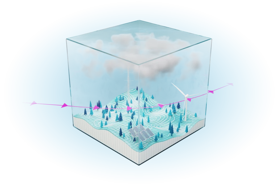
Our meso model
The Whiffle Meso Model is a numerical weather model built on the same physical foundations as our Large Eddy Simulation (LES) model – but at a coarser 2 km resolution.
Meso-simulation
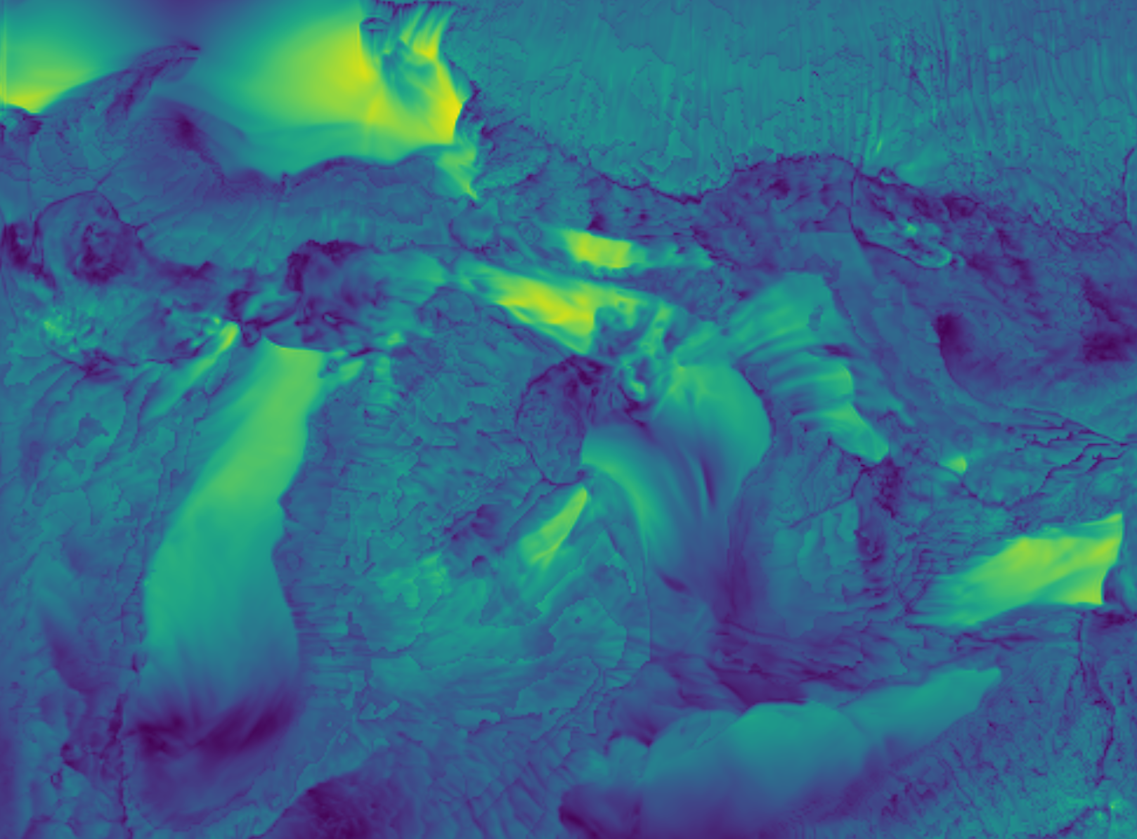
Atmospheric phenomena span a vast range of spatial scales — from microscale turbulence (1 mm – 1 km) to mesoscale events such as thunderstorms, mountain–valley winds, sea breezes, and frontal systems (1 – 100 km), up to large-scale circulations like high- and low-pressure systems, jet streams, and global climate patterns (hundreds to thousands of kilometres). Global reanalysis datasets such as ERA5 represent these largest scales well, while Whiffle’s Large Eddy Simulation (LES) resolves the smallest, turbulent motions in high detail. It is the meso-scale, the range in between, that neither approach fully captures. To close this gap, Whiffle developed its mesoscale model — designed to represent the regional-scale atmospheric processes that drive local wind behaviour and provide consistent boundary conditions for LES simulations.
How it works
The mesoscale model operates at a 2 km horizontal resolution over a 256 × 256 km domain, making it ideal for representing coastal effects, land–sea transitions, and large-scale orography. It captures regional weather dynamics that strongly influence local wind behaviour.
Unlike the LES, it does not explicitly resolve turbulence, as turbulent motions are simply too small (up to about 1 km) to fit on the mesoscale grid. Instead, the mesoscale model uses a set of assumptions – known as parametrizations – that describe the net effect of turbulence on the weather.
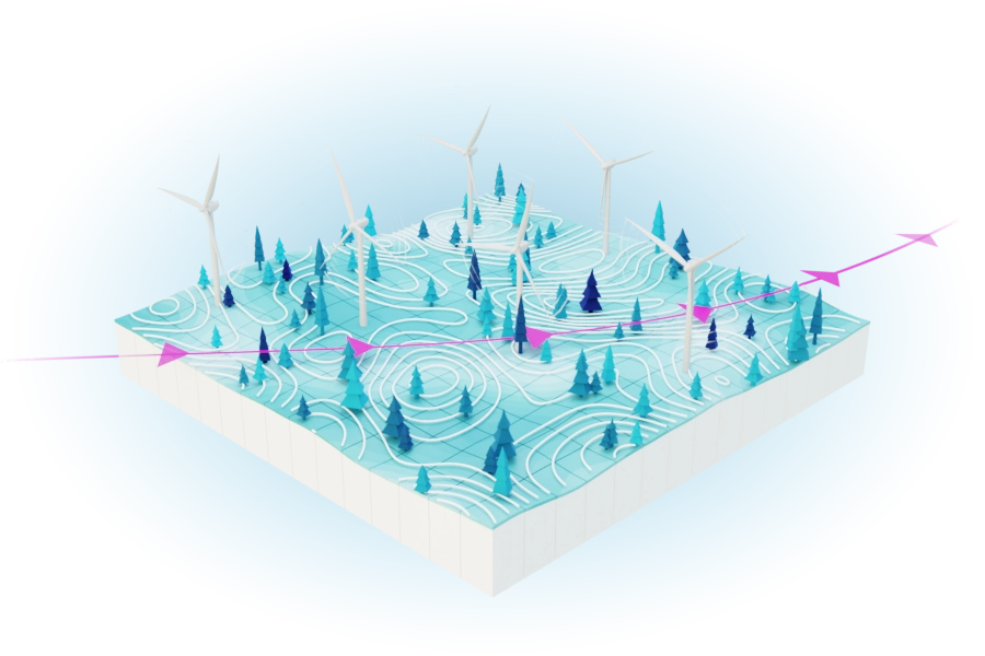
By simulating phenomena such as fronts, sea breezes, and mountain–valley circulations, the mesoscale model provides realistic boundary conditions to the LES, improving flow realism and long-term consistency in downstream simulations.
How it integrates with the LES
The mesoscale model is derived from the same code base as Whiffle’s LES, but with modifications that allow it to operate efficiently at coarser resolution. This means both models share the same physical underpinnings and numerical framework, ensuring consistency across scales.
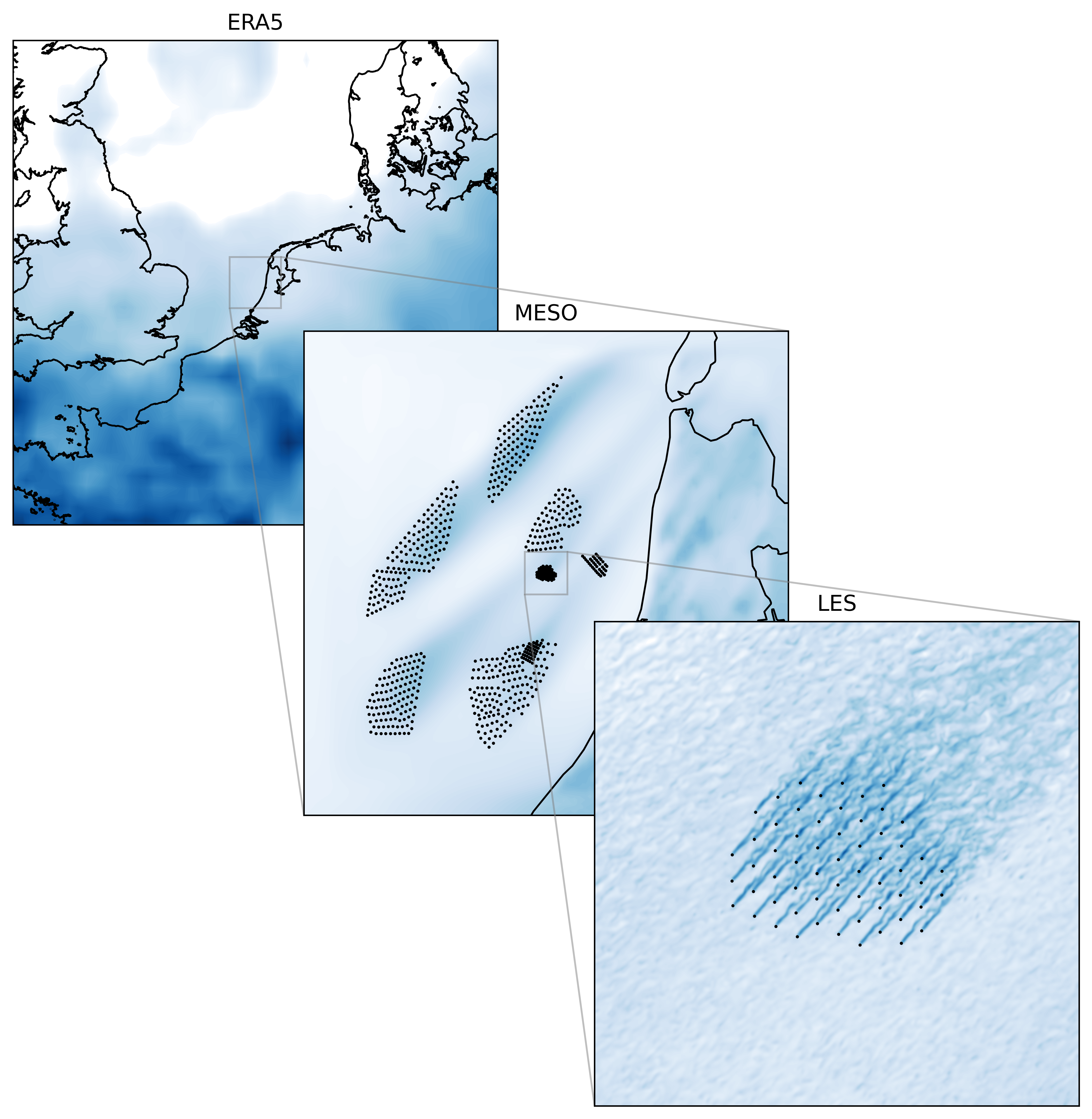
In practice, the mesoscale simulation feeds its output directly into the LES as boundary data, replacing the need to rely solely on reanalysis inputs like ERA5. The result is a more accurate representation of local atmospheric conditions, especially near coastlines and complex terrain.
How Whiffle applies the mesoscale model
As an intermediate layer between large-scale data and the LES
In some cases, large scale models lack certain terrain features (mountains, details of coastlines) that are not included in the LES domain. Adding a mesoscale simulation around the LES domain then improves the representation of these features, ultimately improving the LES results.
As a standalone model for larger domains or long-term studies
The mesoscale model can also be used independently to simulate larger domains or multi-year periods efficiently. This makes it well suited for regional wind assessments and long-term climatologies, as in Whiffle Atlas, which provides 20-year mesoscale datasets at 2 km resolution across multiple regions worldwide
Solutions
Whiffle Atlas
Whiffle Atlas turns the mesoscale model into an instant data service for analysts. With just two clicks, users can access 20-year hourly wind time series at 2 km resolution at any given site, ready to support wind resource assessment workflows like MCP and site screening.

Explore
Want to learn more about our technology? We are glad to share our knowledge and experience with you. Take a deep dive into our technical articles and papers written by our scientists.