
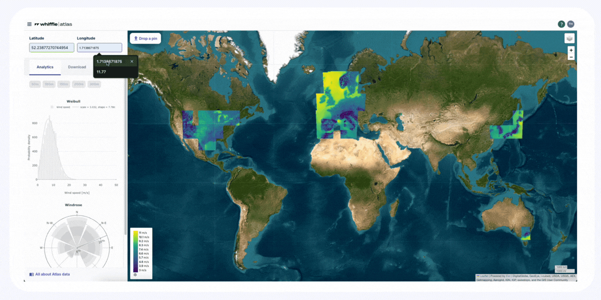

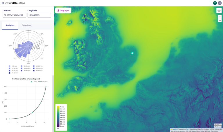
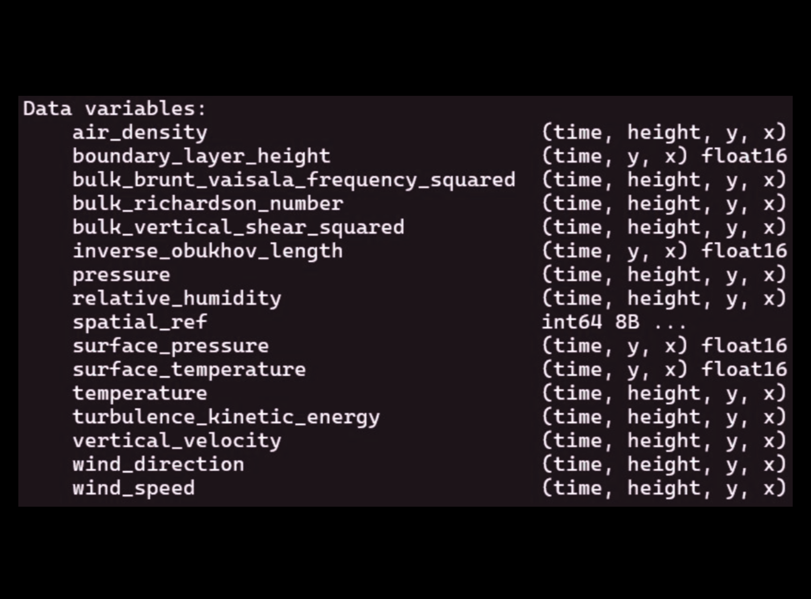
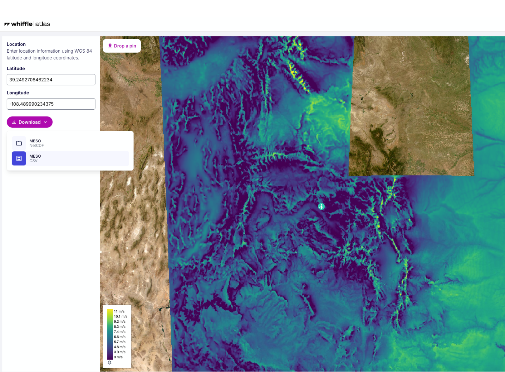
Whiffle Atlas provides finer spatial resolution (2 km), is precomputed, directly downloadable at 10 heights (from 2m to 500m), and validated against over 300 met masts globally.
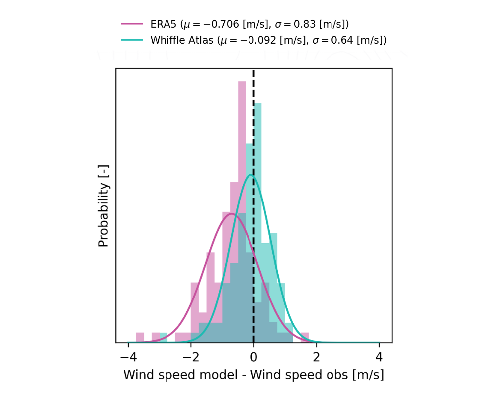
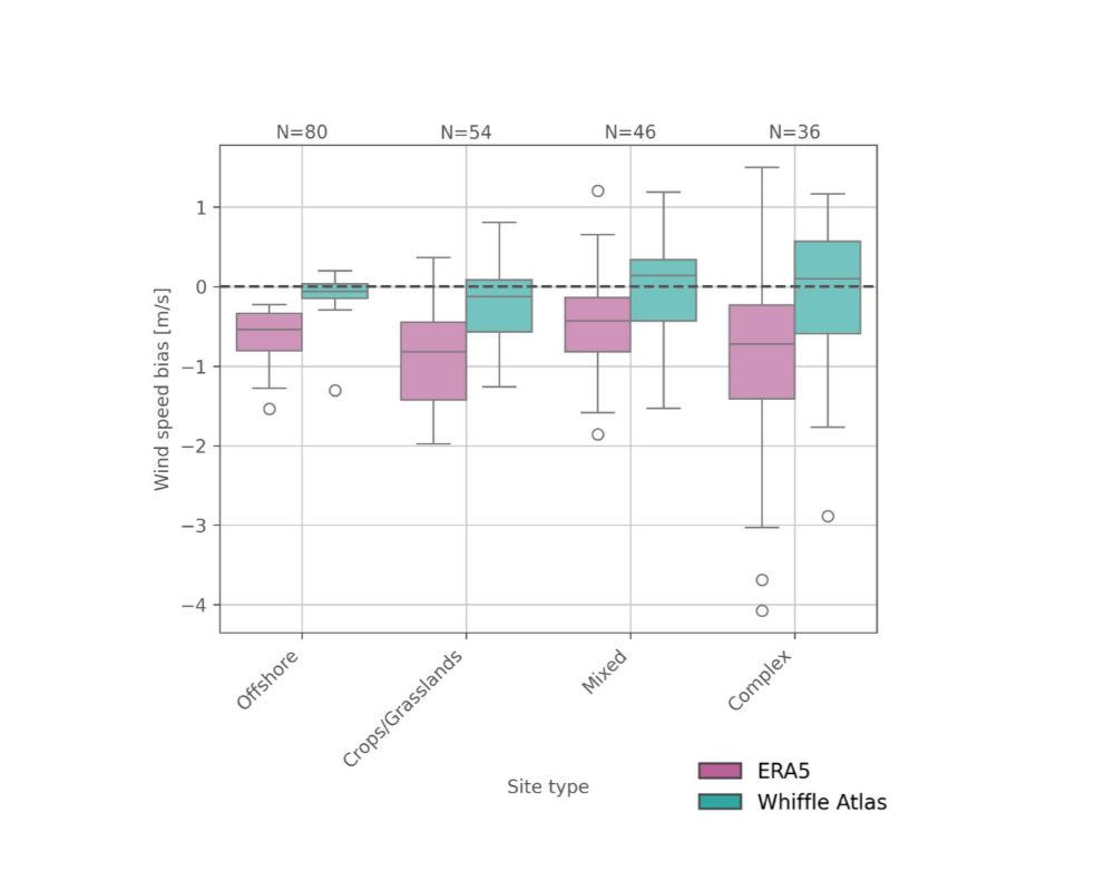
What sets Atlas apart is its performance: across validation campaigns, it shows lower wind speed bias and higher correlation to measurements than other mesoscale datasets. That means reduced uncertainty in long-term wind estimates, especially in nearshore zones, coastal areas, and complex terrain where global models tend to underperform.
Use Atlas as an additional reference in your in your site-screening, alongside ERA5, or as a faster alternative to traditional on-demand mesoscale simulations.