
Most flow models weren’t built for today’s sites
As turbines scale and sites become more complex, model assumptions start to break. Here’s how different approaches perform and where they don’t.
Development pipelines are now dominated by complex terrain, forested landscapes and dense offshore clusters. In these conditions, atmospheric stability shifts yield predictions by 20 to 40 percent and losses from neighbouring farms fall outside what conventional tools resolve
The choice of model is the first source of yield uncertainty
Every model carries its own assumptions about atmospheric behaviour: how stability is handled, whether wake physics are resolved or parameterised, which scales of turbulence are captured. Those assumptions propagate directly into the uncertainty band on your AEP. The four main approaches handle them differently. Here’s what each one resolves, and where its assumptions stop holding.
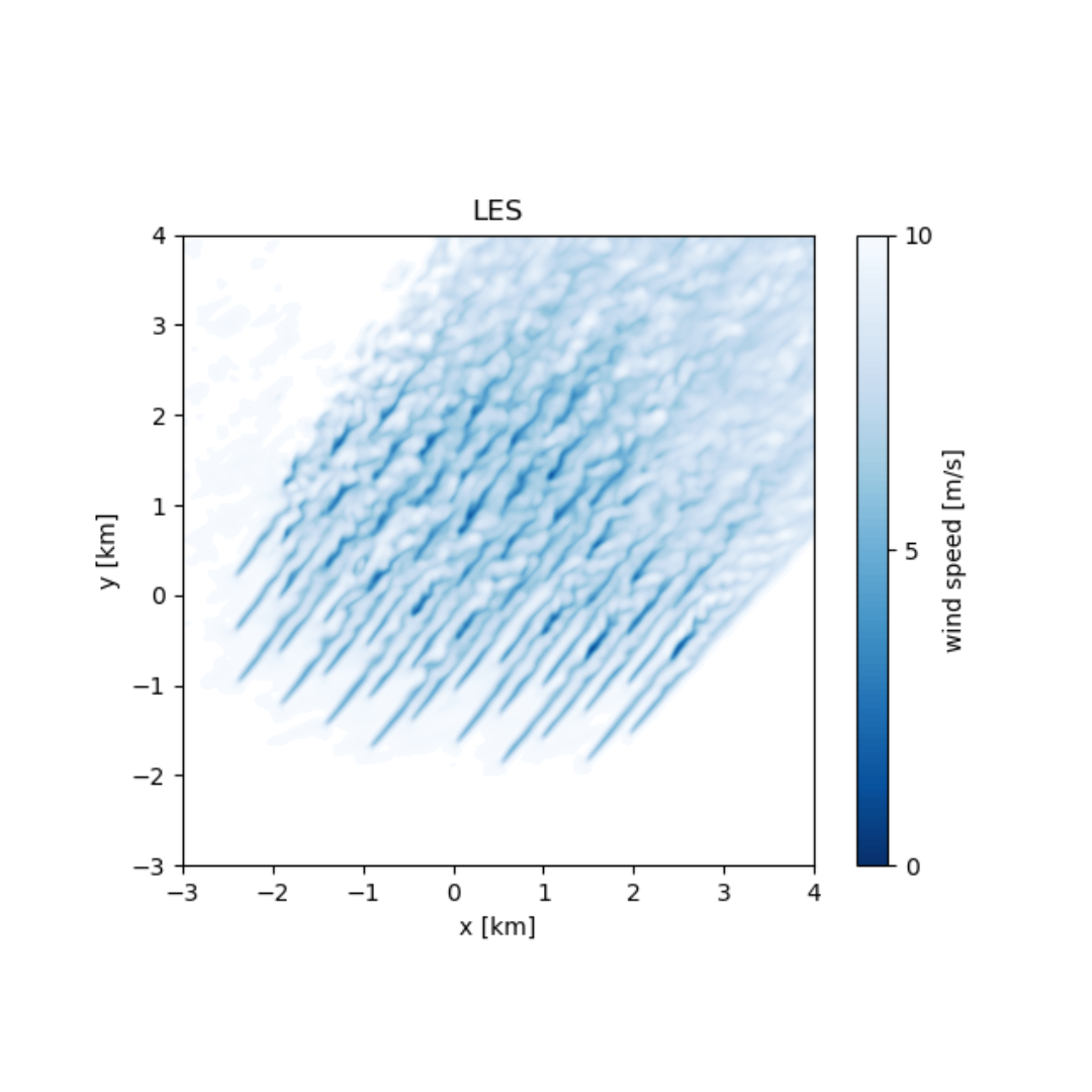
Time-resolved flow at site scale
Atmospheric LES integrates the full range of atmospheric physics: wind, temperature, humidity, radiation, surface energy balance and microphysics. Driven by boundary conditions from a large-scale weather model, it does not rely on assumptions about boundary layer height, atmospheric stability or local turbulence variations. The result is a simulation that represents real weather conditions rather than prescribed ones. Whiffle’s LES model is an atmospheric LES model.
- Resolves shear, veer, gusts and turbulence directly
- Blockage and wake interactions captured at turbine level
- Domains up to 100s of km (mountain flows, far-wake effects)
- No assumptions on BLH, stability or turbulence
- Compute intensive by design (not for rapid layout iteration)
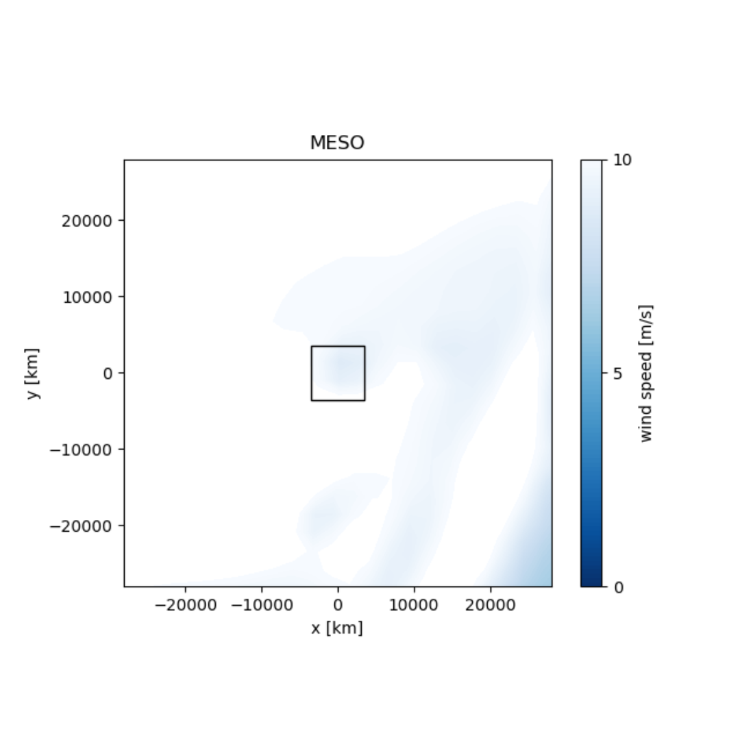
Large-scale atmospheric modelling
Meso-scale models simulate atmospheric behaviour over areas ranging from a few to several hundred kilometres, bridging the gap between large-scale global models like ECMWF’s IFS and high-resolution micro-scale tools. They capture what models like ERA5 cannot resolve at its scale. For strategic planning and site screening they are the right tool. For yield assessment, they need to be combined with a higher-fidelity simulation. Whiffle has a meso-scale model (Whiffle Meso) that runs at 2km.
- Captures sea breezes, orographic flow and land-sea transitions
- Large-scale planning and far-wake studies
- Can under or overestimate wind potential in complex terrain
- Resolution-limited, cannot resolve turbine-scale wakes, internal farm losses or flow around individual terrain features
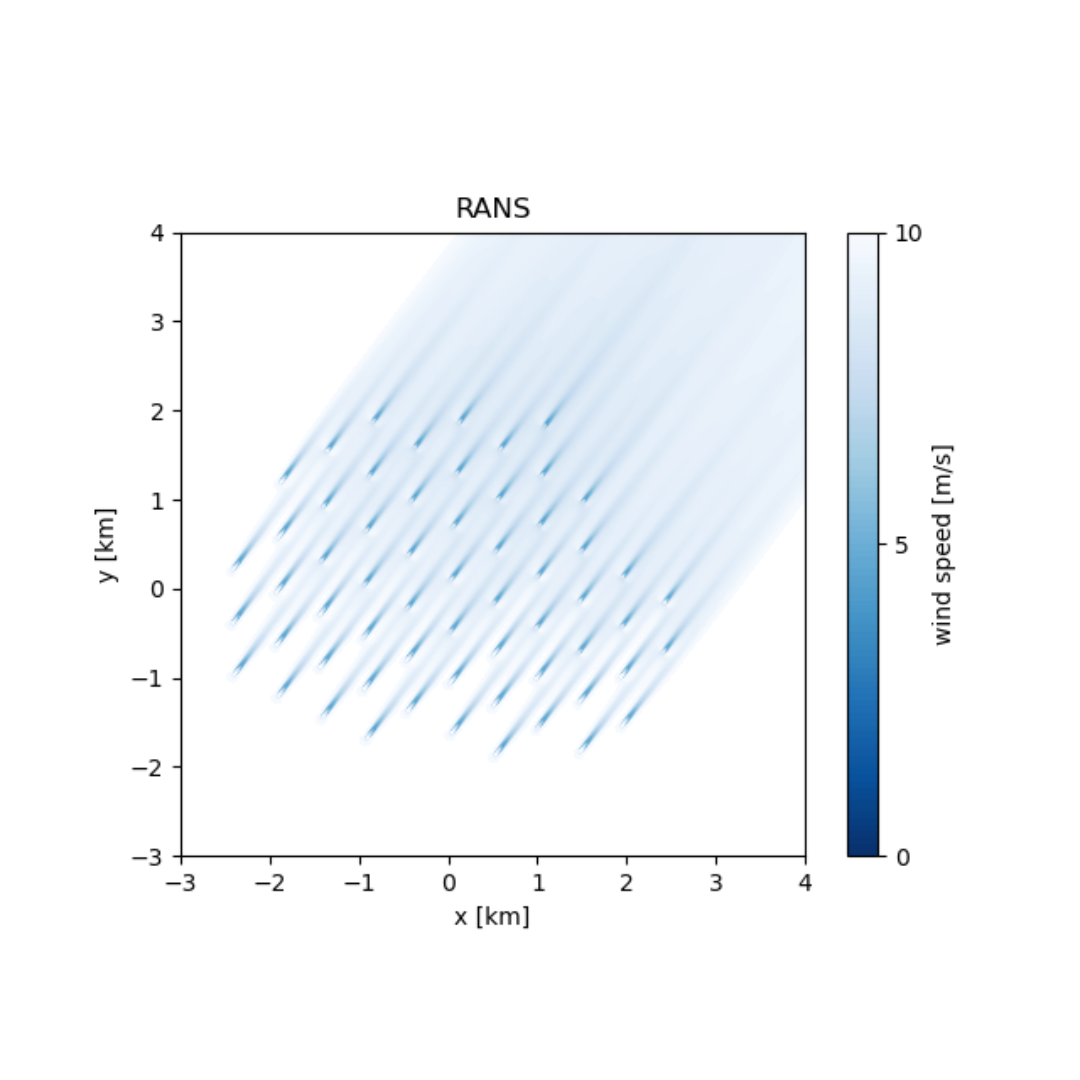
Steady-state flow with modelled turbulence
CFD-RANS models use computational fluid dynamics to simulate wind flow patterns around terrain features and turbines. Often combined with mesoscale or reanalysis input data, they capture small-scale flow details of the site climatology. Their primary limitation is steady-state operation: with prescribed wind speed and direction, they miss essential wake propagation features like wake meandering.
- Detailed flow simulation around terrain features and turbines
- Flexibility in mesh, can account for global blockage
- Wake meandering not captured
- Thermal effects, stratification, BLH not resolved
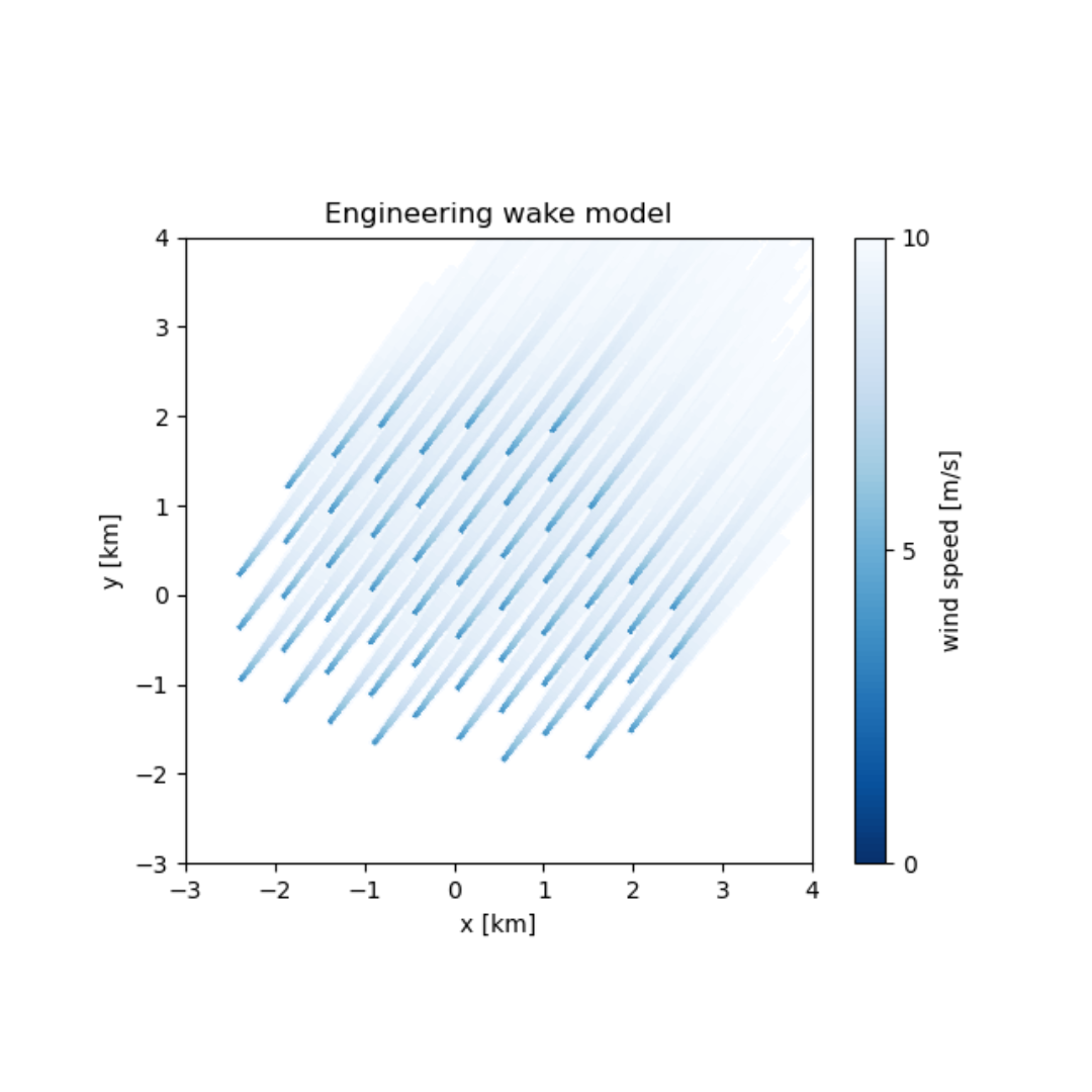
Linearised flow over terrain
Engineering models are the most widely used tools in wind resource assessment, developed from empirical observations. They operate under simplified assumptions: uniform wind flow and static atmospheric conditions, enabling quick computations. Their long-standing industry use allows engineers to make effective empirical adjustments as a reliable baseline for preliminary analysis.
- Fast; ideal for layout optimisation and early-stage exploration
- Easy to interpret, decades of industry calibration
- Limited wake accuracy for larger farms and clusters
- Linearised flow breaks down in complex terrain
Match the approach to the site - here's where the four diverge
- Atmospheric physics
- Wake behavior
- Terrain handling
- Simulation speed
Every model rests on different assumptions about how the atmosphere behaves, how wakes evolve, and what scales of terrain it can resolve. Those assumptions are what decide whether your P50 holds up on the site in front of you, or widens the uncertainty band you carry into the yield assessment. The table below shows where each of the four main approaches holds, and where it stops.
| Where models diverge | Engineering | CFD-RANS | Meso-scale | Atmospheric LES |
|---|---|---|---|---|
| Atmospheric stability | Neutral assumed, not resolved | Prescribed, typically neutral | Parameterised | Resolved from physics |
| Wake meandering | Not captured in most models | Steady-state; not captured | Not captured at turbine scale | Explicitly simulated |
| Far-wake and inter-farm losses | Limited | Not captured beyond domain | Partial — farm parameterisation only | Captured across full domain |
| Internal wake losses in clusters | Limited | Captured within domain | Too coarse to resolve per-turbine | Per-turbine simulation |
| Complex terrain and orographic flow | Linearised — degrades in steep terrain | Well handled | Resolved at grid scale, not turbine scale | Resolved at turbine scale |
| Shear and veer across rotor | Neutral wind profile, no veer | Neutral wind profile, no veer | Resolved at grid scale, not turbine scale | Resolved at turbine scale |
| Long-term wind climate | Assumed from wind rose | Assumed from wind rose | Via representative days or long-term correction | Via representative days or long-term correction |
| Simulation speed (annual run) | Seconds to minutes | Days to weeks | Hours to days | Hours to days |
Whiffle LES and Meso, benchmarked against 170 RWE sites
In one of the most comprehensive independent validations of LES in wind energy, RWE benchmarked Whiffle’s models against 170 sites and over 300 measurement locations, data they compiled and owned entirely. Here are the results:
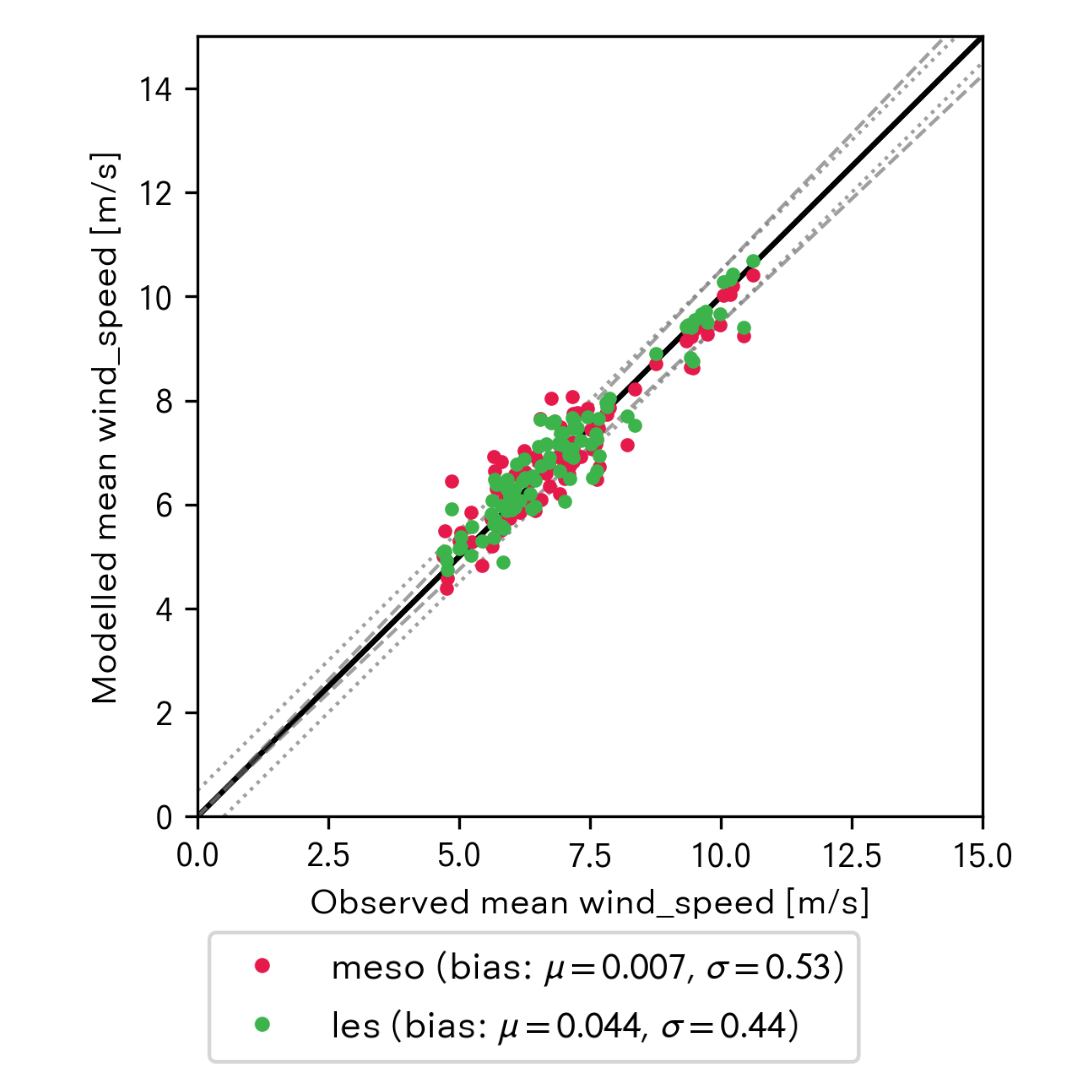
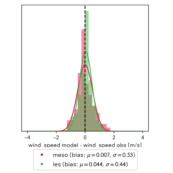
0.4 m/s
0.5 m/s
>30%*
Reduction in wind speed uncertainty (Whiffle LES vs. ERA 5)
*on a 71-site subset of RWE’s study where concurrent Whiffle LES, Meso and ERA 5 outputs were available
The same models, delivered as tools that fit your workflow
Use Whiffle Atlas to get a clear picture of the wind climate at any site, instantly. Use Whiffle Wind when you need to go deeper, with full atmospheric simulations at site level, from early-stage WRGs to bankable AEP.
Whiffle Atlas
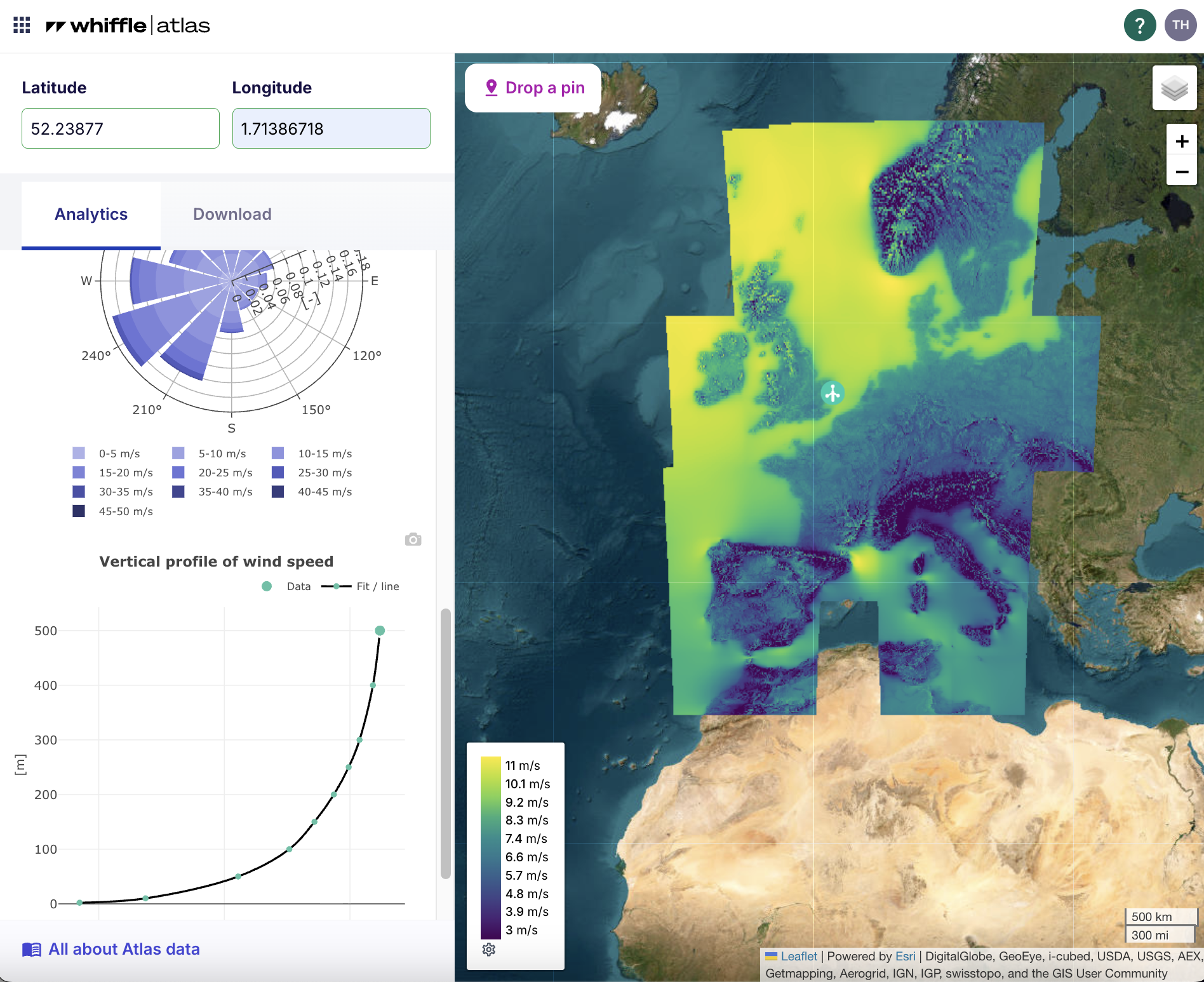
Long-term wind climate
for site screening
21 years of mesoscale wind time series at 2 km resolution. Near-zero mean wind speed bias across all terrain types. Preview site wind statistics (wind rose, Weibull distribution, vertical shear profile) instantly and for free. Download the full time series for sites that make your shortlist.
Whiffle Wind
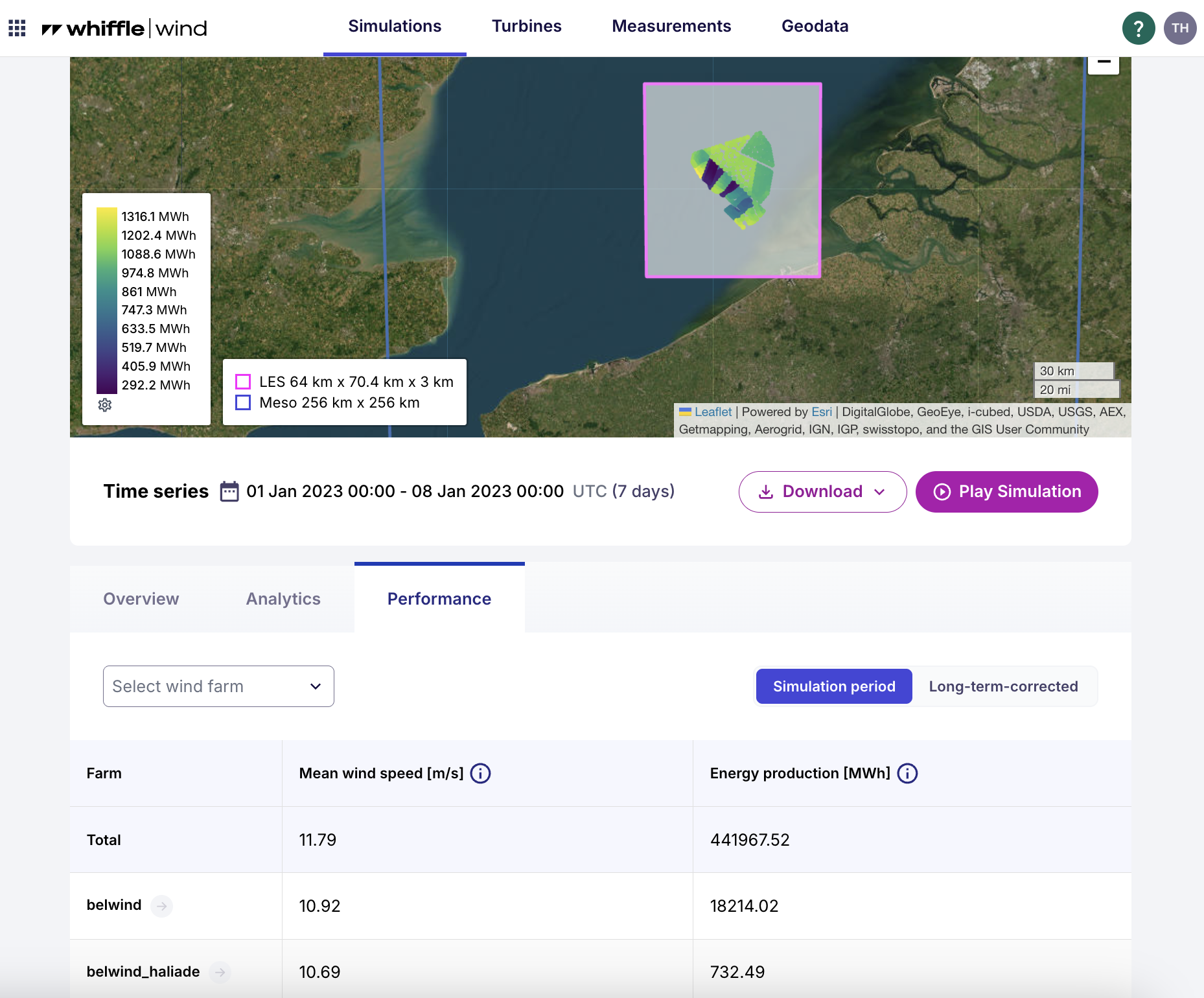
Wind resource assessment &
yield modelling
Atmospheric LES (Whiffle LES) at 100 m resolution (or less), driven by ERA5 and Whiffle’s own meso model. Turbines explicitly in the domain. Outputs WRGs, full hourly time series and per-turbine AEP, compatible with wind resource assessment tools like WindPRO and OpenWind.
Get the right answer for your site
Our atmospheric scientists work with wind resource engineers across the full range of site types and project stages. Tell us about your site and we will tell you which modelling approach fits – and why.
Whiffle
Molengraaffsingel 8
2629 JD Delft
